


Independence Voting District, Tate County, Mississippi
About
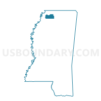
Outline

Summary
| Unique Area Identifier | 606749 |
| Name | Independence Voting District |
| County | Tate County |
| State | Mississippi |
| Area (square miles) | 49.90 |
| Land Area (square miles) | 49.86 |
| Water Area (square miles) | 0.04 |
| % of Land Area | 99.91 |
| % of Water Area | 0.09 |
| Latitude of the Internal Point | 34.71915270 |
| Longtitude of the Internal Point | -89.79333550 |
Maps


Graphs
Select a template below for downloading or customizing gragh for Independence Voting District, Tate County, Mississippi


Neighbors
Neighoring Voting District (by Name) Neighboring Voting District on the Map
- Alphaba Cockrum Voting District, DeSoto County, MS
- Coldwater Voting District, Tate County, MS
- Ingram's Mill Voting District, DeSoto County, MS
- Palestine Voting District, Tate County, MS
- Poagville 5 Voting District, Tate County, MS
- Thyatira Voting District, Tate County, MS
- Wall Hill Voting District, Marshall County, MS
- Watson Voting District, Marshall County, MS
- Wyatte Voting District, Tate County, MS
Top 10 Neighboring County Subdivision (by Population) Neighboring County Subdivision on the Map
- District 1, DeSoto County, MS (44,651)
- District 5, DeSoto County, MS (38,509)
- District 4, Marshall County, MS (7,456)
- District 5, Tate County, MS (5,083)
- District 3, Tate County, MS (4,819)
Top 10 Neighboring Unified School District (by Population) Neighboring Unified School District on the Map
- DeSoto County School District, MS (161,252)
- Marshall County School District, MS (25,068)
- Tate County School District, MS (19,143)
Top 10 Neighboring State Legislative District Lower Chamber (by Population) Neighboring State Legislative District Lower Chamber on the Map
- State House District 6, MS (46,182)
- State House District 8, MS (27,100)
- State House District 5, MS (23,098)
- State House District 11, MS (21,994)
Top 10 Neighboring State Legislative District Upper Chamber (by Population) Neighboring State Legislative District Upper Chamber on the Map
- State Senate District 1, MS (78,258)
- State Senate District 10, MS (60,426)
- State Senate District 2, MS (57,319)
Top 10 Neighboring 111th Congressional District (by Population) Neighboring 111th Congressional District on the Map
Top 10 Neighboring Census Tract (by Population) Neighboring Census Tract on the Map
- Census Tract 9503, Marshall County, MS (7,138)
- Census Tract 9505, Marshall County, MS (7,004)
- Census Tract 9502, Tate County, MS (6,669)
- Census Tract 9501, Tate County, MS (5,636)
- Census Tract 709, DeSoto County, MS (4,522)